Fires & Floods
Fires and floods have affected the landscape of the Gila. Often the affects last for years if not decades. Learn about what to expect if various flood and fire areas.

Fires in the Gila National Forest
While fires are a part of keeping the southwest landscape healthy, mismanagement and drought have caused mega-fires.
Mega Fires: affect trail systems for years/decades to come.
- Deadfall block trails (sometimes 1000’s of trees) and can make travel hazardous (trees falling).
- New Mexican Locust, which can grow back in 3 months after it has been brushed, makes travel even more difficult and can obscure the trail. This plant has very sharp thorns that rip clothing and skin, making travel unpleasant.
- Significant post fire flooding can obliterate trails and landscapes – Sometimes whole hillside disappear or there are 20 foot drop offs at creek crossings.
Gila Wilderness
Johnson Fire 2021 and Post-Fire Flooding
While this was generally a healthy burn, it still caused damaged in small high intensity burn areas and post-fire flooding. Areas most affected include:
- Mogollon Creek and trails in the creek (flooding)
- West Fork Trail #151 – major trail washout in one spot between Nat Straw and Ring Canyon (photo link does not do it justice) impassable for stock.
- Turkey Creek and Trail #155 (fire and flooding)
- Miller Springs Trail #159 (fire)
- Packsaddle Mesa and trails nearby (fire)
- Ring Canyon Trail between #789 and Mckenna Park (flooding).
Resources: See Forest Service Fire Severity Map
Whitewater Baldy Complex Fire 2012 & Post-Fire Flooding 2013
High intensity burn in much of the mixed conifer and old growth aspens of the West side of the Gila Wilderness. It affected much of the Glenwood trails and high-country trails around the Mogollon Mountains.
Flooding majorly affected:
- Cooper Canyon (upper part of West Fork Trail – no longer passable) See map for new trail around this washout
- Turkey Feather Creek (also upper part of West Fork Trail – not passable for stock)
- Mogollon creek and trail – (Upper part of Mogollon Creek is not passable for stock. Lots of cut banks and logs to step over for hikers)
- Middle Fork Trail #157 (Much of the flooding on the Middle Fork was repaired but subsequent flooding in 2022 has caused additional damage.
- South Fork Whitewater Trail # 212 (not passable for stock)
- #217 (gone after the waterfall)
Logs are falling fast in this high intensity burn area. Even though it has already been a decade, there are still many standing dead trees in these areas. There is a lot of locust that has grown up in the trails.
Resources:
- Forest Service Fire Severity Map
Aldo Leopold Wilderness
Black Fire 2022 and Post Fire Flooding
This fire burned the entire Aldo Leopold Wilderness and significant parts of the Black Range all the way to Hillsboro Peak. The Crest of this area was most severely burned while other parts were mild to moderate. Significant amount of old growth mixed conifer destroyed in this fire.
Flooding damaged many of the trails in the Aldo Leopold. Reconstruction of the some these trail is in progress but it will take years to repair all the trails.
Expect lots of New Mexico Locust (a thorny plant that grow fast) in many areas of the severe burn. This plant is hard to manage since it can grow back to 4+ feet tall in only a few months.
Silver Fire 2013 and Post Fire Flooding
High intensity burn in much of the mixed conifer and old growth aspen of the south side of the Aldo Leopold Wilderness and Black Range. It affected from Reed’s Peak south to Sawyer Peak. Logs are falling fast in this high intensity burn area- even if trails have been cleared, there are likely logs on the trails again after a week. There is a lot of locust that has grown up in the trails.
Due to flooding washouts, the following trails will be extremely difficult to travel on:
- North and South Fork of the Mimbres
- Water and Pretty Canyon Trails
- Aspen Mountain from Signboard Saddle to Reed’s Peak
- Crest Trail from Reed’s Peak to Mcknight Mtn
- Mimbres River Trail #77 above Monument Canyon
- Quaking Aspen #86 – east of the junction with Rabb Park Trail
- Sids Prong #121
The following trails have been worked on since the fire but they still may have newly fallen logs and lots of locust. Please note that these trail were also in the Black Fire 2022.
- Crest Trail #79 from Mcknight Mtn to Hillsboro Peak
- Holden Prong # 114
- Gallinas Canyon #129 (upper parts)
See Forest Service Fire Severity Map
Non-Wilderness Fires in the Gila
Trout Fire 2025
The Trout Fire was discovered on June 12, 2025. It would eventually burn more than 47,000 acres.
You can read how the trails are affected by the fire.
And see photos of the CDT near Signal Peak and Black Peak from 2025 and Allie Canyon Trail May 2026 (post hazard tree removal along the trail)
Tadpole Ridge Fire 2020
This lightning started 40+sq kilometer fire mainly affected the
Signal Fire 2014
This human caused fire affected a number of trails in the Signal Peak area. Most of the trails have been initially rehabbed although logs continue to fall and locust still grows back each year.
The fire and flooding also affected the Signal Peak Road. While still accessible, the road is narrower than pre-fire.

Floods & the Gila National Forest
General Gila Flooding: Our clear running rivers look like small streams, but these rivers can turn muddy brown, and rage over our heads through the canyons. Some examples are snow run off, rapidly melting snow from a mid-winter rain, or monsoons/ fall rains. River levels can stay up (impassable) for weeks and sometimes months.

Low Flow
This is what the water in the Gila area looks like most of the time.

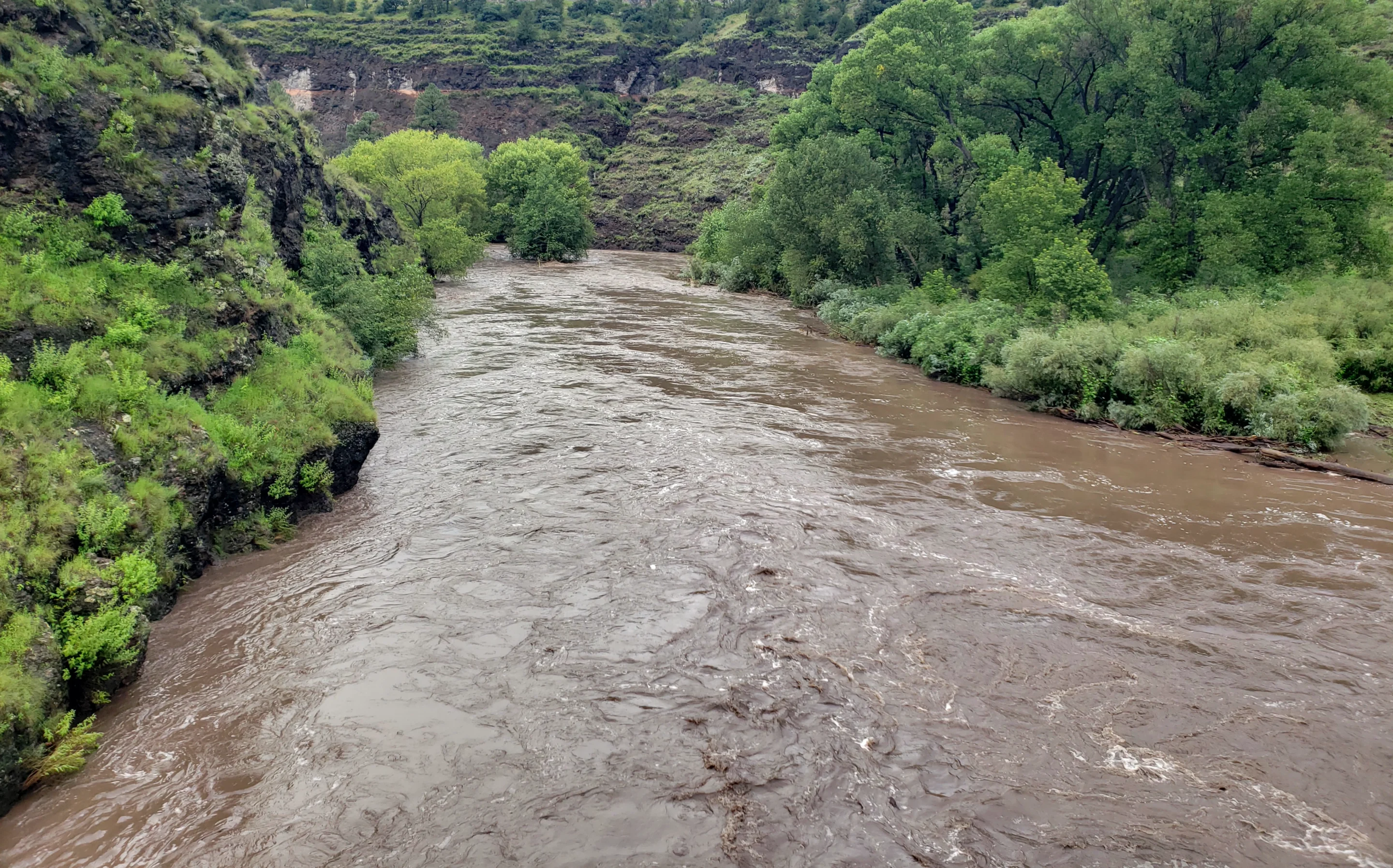
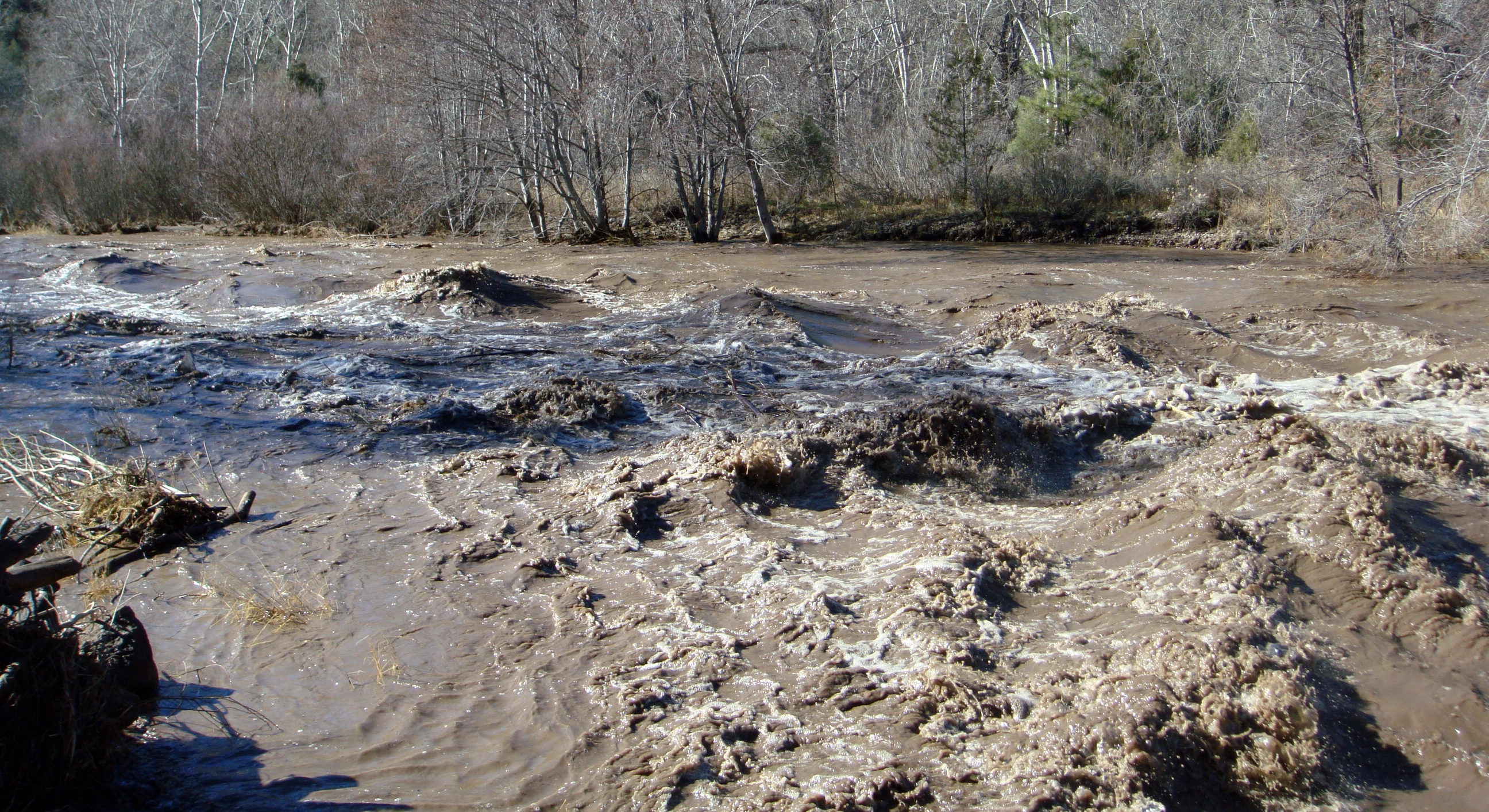
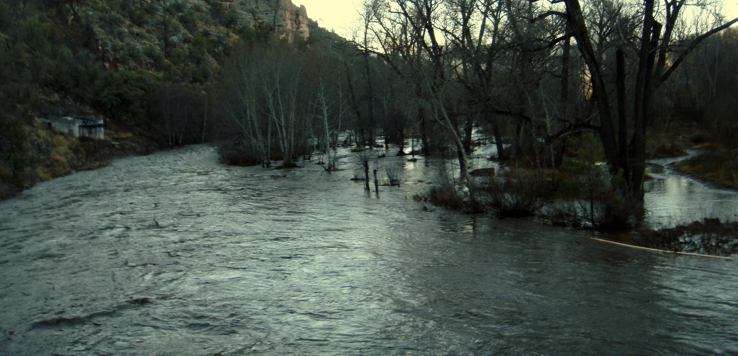
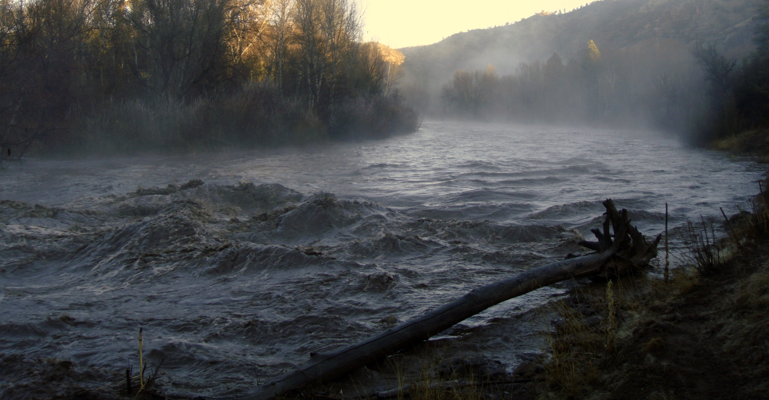
High Flow
This is what the rivers can look like during monsoons, heavy rain or winter/spring snow melt.
Gila Wilderness
Middle Fork Gila River
The Middle Fork floods often. Keeping the trail open and easy to find on the Middle Fork is an impossible task with the minimal work force to keep the trail open. Thanksfully it is hard to get lost in a canyon bottom and a beautiful place to explore. Just be ready for a less then prime trail.
Much of the flooding from the Post Whitewater Blady Fire flooding has been repaired expect for the Middle Part between Flying V and Meadows. One section 3 miles upstream from the Meadows is now too narrow for horses because of the flood damage.
In 2022, a record monsoon year caused more flooding, which washed out some parts of the trail and made most of the river crossing confusing. And the trail crosses the river many many times.
West Fork Gila River
The West Fork floods often. Two floods currently affecting the West Fork Trail are:
- Johnson Fire 2021 – The most significant effects is the major trail washout between Nat Straw and Ring Canyon. It is impassable for stock. Finding a way around may be advisable.
Main Gila River
The Main Gila River Floods often. Although Gila River Trail from the Grapevine Campground to Sapillo Creek has been repaired, willows grow back quickly making navigation challenging.
Tributaries to the Gila River
Smaller drainages can flash flood also. This often causes trail washout. Check out the Trails Not Recommended list and the associated Map for drainages that have washed away trails that are gone for the foreseeable future.
Trails that have recently washed out but will hopefully be open again soon include:
- Mogollon Creek – This area recieved 3.5 inches of rain in one hour causing the river guages on mogollon creek to jump from 3 cfs to 6000 in 2 hours. Expect this trail to have several washouts.
- Upper Mogollon Creek: washed out after the Johnson Fire. Passable for agile backpackers but nor for equine.
- Turkey Creek – sections were washed out after the Johnson fire in 2020. More damage may have been done after monsoonal flooding in 2022.
Aldo Leopold Wilderness
Post Black Fire Flooding
After the Black Fire in 2022, this area experienced record monsoons which caused extensive flooding on creeks and rivers in the Aldo Leopold Wilderness and Black Range.
Silver Fire 2013 and Post Fire Flooding
High intensity burn in much of the mixed conifer and old growth aspen of the south side of the Aldo Leopold Wilderness and Black Range. It affected from Reed’s Peak south to Sawyer Peak. Logs are falling fast in this high intensity burn area- even if trails have been cleared, there are likely logs on the trails again after a week. There is a lot of locust that has grown up in the trails.
Due to flooding washouts, the following trails will be extremely difficult to travel on:
- North and South Fork of the Mimbres
- Water and Pretty Canyon Trails
- Aspen Mountain from Signboard Saddle to Reed’s Peak
- Crest Trail from Reed’s Peak to Mcknight Mtn
- Mimbres River Trail #77 above Monument Canyon
- Quaking Aspen #86 – east of the junction with Rabb Park Trail
- Sids Prong #121
The following trails have been worked on since the fire but they still may have newly fallen logs and lots of locust. Please note that these trail were also in the Black Fire 2022. See update under the Black Fire.
- Crest Trail #79 from Mcknight Mtn to Hillsboro Peak
- Holden Prong # 114
- Gallinas Canyon #129 (upper parts)